"To the visitor today, medieval Bath is invisible. The signs, the guide books, the tours and the publicity all talk about Bath, the Roman City and Bath, the Georgian City: it is as if there were nothing in between. Indeed, for the modern visitor this is true. Bath has no timber-framed houses overhanging narrow streets, no ancient parish churches, no castle." (PD)
And, one might add, not that much in the way of Roman remains either. When the tour guides talk about 'Roman Bath', what they really mean is 'The Roman Baths'. There are no villas, no markets, no workshops. All that has survived is a nucleus of public buildings. Impressive they are - but a Roman city they most certainly are not!
Saxon Bath
Given the length of time since the Roman occupation, few traces of everyday life might be expected. It is perhaps more surprising that so little survives from the period 410 to 1700. For well over a thousand years people laboured in the city, built houses, married and raised children, worshipped and were buried here. And yet there is little that marks their passing.
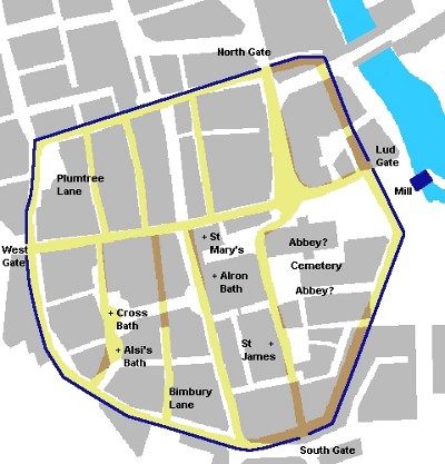
A brief glance at some historical maps of Bath suggests why this might be. The first is derived from a sketch map on Jean Manco's web site, Bath Past (JM). It is a partly-conjectural reconstruction of the city as it might have looked in late Saxon times, somewhere around 890. The city walls and the mill are dark blue. Saxon streets are marked in yellow, and are darkened where they pass beneath existing buildings. The modern layout appears in grey.
The Saxon walls are thought to have followed closely, perhaps exactly, the line of the Roman ones (JM). There may have been limited development outside the city, as there was in Roman times, but Bath at this time was contained largely within its defensive perimeter (PD, JM). Interestingly, many of the streets still exist today, on or close to their original line.
Medieval Bath

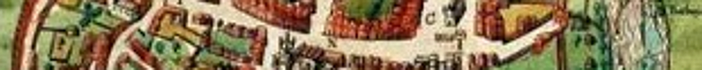
The second map appears in several guises: as the Savile Map of c.1600 (JM), the Speed map of 1610 and the Guidot Map, a Dutch copy from 1676. This one is the 1610 version (GM).
Again the city lies within its walls, which are virtually the same as in Saxon times, with only limited development beyond. The east gate (the Saxon Lud Gate) has been moved a little to the north, and the church of St. James rebuilt by the south gate, which has also been relocated. There are now four parish churches in the city, as well as one outside. Of these only St. Michael's Without, beyond the north gate, survives today. It was largely rebuilt in the 19th c.
Georgian Bath
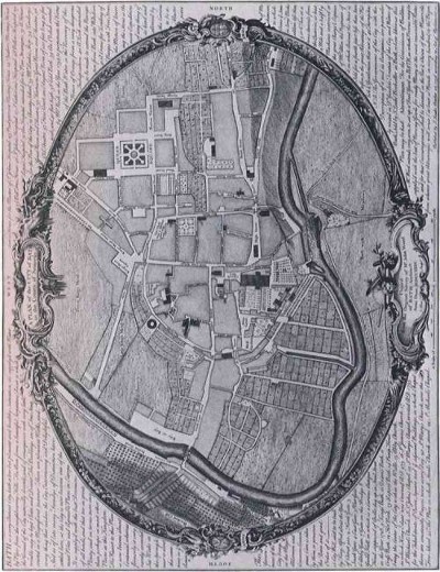
It is 1735 and the Georgian architects have moved in. The outline of the city can still be traced in the centre of this plan by John Wood the Elder (GM), but significant development has taken place to the north, around Queen Square. The line of the walls is now unclear south and east of the abbey.
Incidentally, the great man seems to have had a low opinion of the place as he first found it:
"Soil of all sorts, and even carrion, were cast and laid in the streets, and the pigs turned out by day to feed and rout among it; butchers killed and dressed their cattle at their own doors; people washed every kind of thing they had to make clean at the common conduits in the open streets." (BC)
He had a vision of a new and elegant Bath rising from the dirt and confusion of the medieval town, and set about realizing his dream. The result, recognizable to anyone familiar with Bath today, appears below (GM).
Victorian Bath
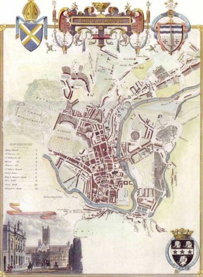
We have reached the year 1836 and the Georgian rebuilding is complete. The walls have largely disappeared and the old city is now just a small frament of a greater whole, hardly discernable unless you know what you are looking for. For one thousand six hundred years the layout of Bath was surprisingly constant, but now it has changed out of all recognition.
There were several other phases in the evolution of Bath. Throughout the 19th and 20th centuries ripples of development spread out from the centre. During the war the city was bombed, resulting in significant damage and subsequent rebuilding. A map at the Bath Blitz Memorial Project website (BB) records where the bombs fell. And it was badly knocked about by the urban planners of the 60s and 70s.
Considering the changes that have taken place over the centuries, it is a miracle that anything remains of pre-Georgian Bath. As it happens there are still a few fragments to be seen. With the help of a certain amount of imagination, they give some idea of what the place might have been like. They are described in the next section.