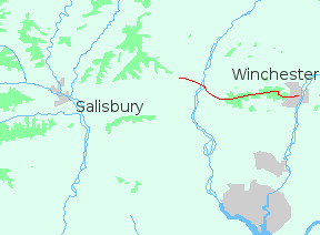
It's twenty-four miles from Winchester to Salisbury, along the Clarendon Way. For the most part you are on footpaths, though close to the cities there are a few roads. The countryside is attractive rather than spectacular; with rolling downland, woods and chalk streams. There are occasional quiet villages; and at the start and finish a great cathedral. It's a rewarding journey.
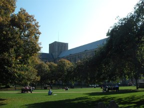
I set out on a warm day in October. From the city centre the Way led south along shaded walks to St. Cross Hospital. There it abandoned the river, climbing through outlying estates up onto Teg Down.
As I walked I could see the South Downs away to the east: sun-dappled uplands under an azure sky. The weather was fine, the air warm with the last breath of summer. In woods and hedgerows the trees were verdant, scarcely touched by autumn's gathering.
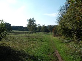
After Teg Down the Way joins the old Roman road from Winchester to Sarum. The road can be busy at times; but there's a footpath which follows the verge, ghosting through a tunnel of overhanging branches. At Farley Mount Country Park it becomes a track, crossing a wide expanse of burnished grass.
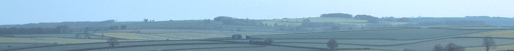
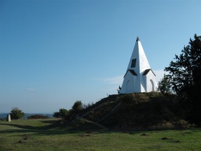
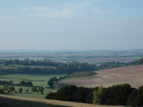
From the park the Clarendon Way ascends to the monument on Beacon Hill. As I climbed, the land opened up. South of the hilltop the chalk spread away in long waves. On the other side of the ridge the view was even more spectacular. Before me lay the valley of the Test, golden in the afternoon sunshine. I could make out the downs near Salisbury; and northward the high hills edging the Vale of Pewsey.
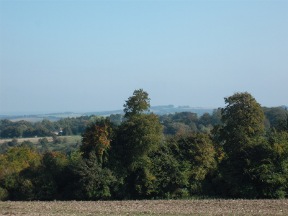
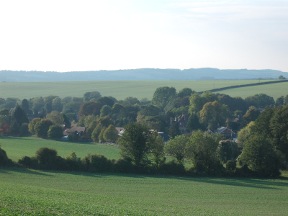
Soon the path sloped down from the ridge, crossing a belt of undulating farmland. As I came over the last rise I caught sight of King's Somborne, half-hidden among trees.
There's a B and B in the village, as well as a shop and pub, so it would be possible to break your journey here. I didn't do so as I was heading for Broughton, four miles further on. A patch of woodland was marked on the map, up on Broughton Down, where I hoped to camp.
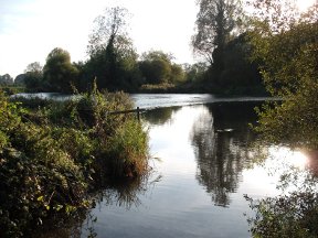
Beyond Kings Somborne the path crosses the Test Way, coming south from Stockbridge. Then over the water meadows, where the bright stream flows in many channels, and up a little side valley to Broughton.
I had walked the Clarendon Way before, stopping at the Greyhound in Broughton for lunch. It was a long time ago, and I couldn't remember much about it; but I did recall a tasty gammon steak. Having covered twelve miles I was starting to feel hungry, and I hurried on through the quiet countryside, mouth watering.
They always say: don't go back. It's never the same. The Greyhound certainly wasn't. Once a country pub, it had been turned into an Italian-style bistro. The interior was cool and impersonal, with a stone pizza oven in one corner; and the lager (premium Italian, naturally) cost four quid a pint!
I felt rather out of place with a rucksack, so I went out onto the terrace. Sitting there in the lamplight I didn't realize how quickly night was falling. I climbed Broughton Down, on tracks barely visible in the darkness, and there I set up camp under the trees.