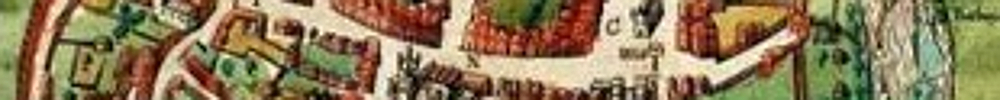
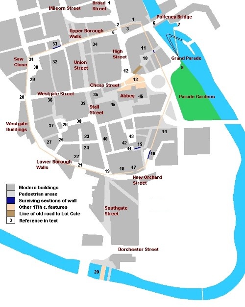
Numbers in brackets in the text refer to locations marked on the map. Some photos have features present in 1610 superimposed.
You can download a portable document format (pdf) version of the walk using this link.
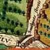
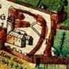
St. Michael Without The Walls
The walk begins in front of the church of St. Michael With St. Paul (1). In medieval times it was known as St. Michael Without or St. Michael Without The Walls, and was one of five churches serving the city.
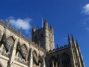
In 1539 the last prior of Bath, William Holloway, surrendered what is now Bath Abbey to the Crown. For some years the old monastic church was allowed to decay, but in 1572 it was acquired by the town for restoration as a new parish church. Bath's economy was based in medieval times on the wool trade and on weaving (JM) - the Cotswolds, famous for sheep, lie just to the north. But things were changing. Visitors, attracted by the medical benefits of the springs and the increasingly lively social scene, were bringing in new money; and Bath required a grand church to match its growing reputation (JM). Although the rebuilding of the abbey was not completed until 1617, the parishes within the walls were amalgamated in 1583, and within a few years three of the churches inside the walls had closed. Of the original parish churches, only St. Michael's survives (PD).
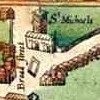
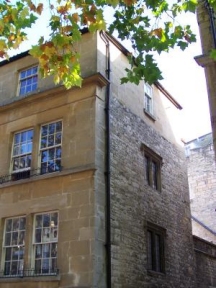
The church you see today is actually the fourth on this site. The first was in existence by 1170, although it may well have been older. The second, which was built around 1400, lasted until 1743 when it was in such a bad state of repair that it had to be replaced. The present St. Michael's, consecrated in 1837 (MP), is worth a look. It’s in surprisingly good taste for a Victorian church (OK, it is early Victorian!) There's a model of the third, the one Jane Austen would have known, inside.
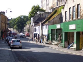
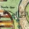
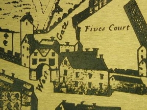
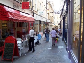
At the church, the road leading from the north gate divides. The left arm is Broad Street, named after the weavers who worked in this quarter of the city and the broad cloth they produced (MP). To the right is Walcot Street. The council promotes Walcot as Bath's "artisan quarter" - a little fancifully, perhaps, but it is still interesting to explore. There are several small workshops, as well as shops selling antiques, bric-a-brac, olives and other interesting things. Near the top of the street is the Bell, a pleasantly grotty pub that often has live music.
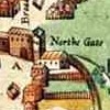
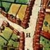
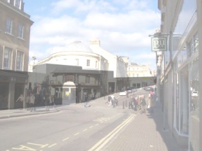
However, to return to the church. Stand outside and look south to the abbey. In Speed's time the view would have been blocked by the north gate (2), with the tower of St. Mary By The North Gate showing above the wall (3). This was the poorest quarter of Bath, a working suburb on the edge of the countryside. In 1630 there was a tannery by the gate, and cattle wandered in the streets (JW).
In the road in front of you, just before the triangular pavement, was St. Michael's conduit (shown as a fountain on the Gilmore map). By 17th c. standards Bath had quite an efficient water supply. Spring water from the surrounding hills was brought to the city along channels of lead, wood and stone, where it could be drawn from public conduits. A few houses even had a private supply laid on (JW).
St. Michael's to Slippery Lane
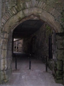
Walking towards the abbey you come to a narrow alley opening to your left, next to the New Saville Row barber's shop (4). Slippery Lane, as it is known, follows the outer face of the old city wall. The end is now blocked off, but in 1610 it gave access to the river and the ferry over to Bathwick. Here if anywhere you can imagine what the streets of a medieval town would have been like. The smell and the dirt still exist; add a few chickens scratching about and a servant emptying slops from an upper window and the picture is pretty much complete! A visitor in 1640 described the streets of Bath as 'foul-smelling, with rubbish accumulated on the footpaths'. In 1646 bylaws were introduced to try to improve matters, though how effective they were is open to question. Nine years later John Evelyn still found the unlit streets to be 'narrow, uneven and unpleasant'. In the 17th c. they were patrolled by a bellman and two watchmen. If they saw a crime or fire the bellman would ring his bell to raise the alarm (JW).
The church of St. Mary By The North Gate was a few yards down the alley, behind the wall to the right. By 1583 it had closed; the main part of the building became St. Edward's Free School (the school moved to Broad Street in 1754) while the tower was used as a prison. It was finally demolished in 1771 (BA).
Directly opposite the entrance to Slippery Lane was another road leading west. The city gates were locked at night, even in peacetime (JW), so Barton Lane linking the north and west gates outside the walls would have provided a kind of bypass (PD).
Emerging from Slippery Lane, face to your left. The line of the wall is a couple of yards (metres) in front of you. The north gate was in the middle of the road, just to your right. The city gates are shown on the Speed Map with rounded arches about 10 feet (3 metres) wide; the north gate also had a separate pedestrian arch (2). Each of the main gates (north, west and south) was defended by a low tower (PD).
A few steps and you are inside the walled city.
One of the striking things about Bath in 1610 is how small it was. The walls enclosed an area of about 24 acres (9 hectares). There is no accurate census from this time, but estimates from documents such as tax rolls suggest a population of around 2000 (JW PD). On the Speed Map the main streets are lined with continuous rows of houses, but there is a considerable amount of open space elsewhere. Many houses are shown with large gardens to the rear, which in part at least would have been planted with herbs, salads and vegetables. Poultry and pigs, useful recyclers of domestic waste, would have been kept, no doubt contributing to the interesting odours drifting through the 'foul-smelling' streets. And there would have been workshops; in 1625 there were 16 shoemakers in the city, and 12 glovers (JW), all presumably with labourers and apprentices. It sounds a lot for a resident population of 2000; but then again Bath was a regional market centre, buying up the produce of outlying villages and supplying them with goods and services.
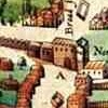
As you face the Abbey the road leading off to the right is Upper Borough Walls. For most of its length it follows the line of the city wall, but at the junction with the High Street it bends slightly. The Speed map shows a cluster of buildings just inside the gate, against the wall (5). The modern road, with its slight deviation, still suggests where they would have stood. Much of old Bath is like this: a ghostly impression still to be traced in the alignment of present buildings and streets, though its physical form has long since gone. In 1694 one of the buildings inside the gate was an inn, the Seven Stars.
Slippery Lane to Pulteney Bridge
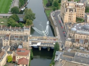
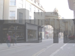
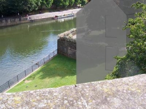
Turn left into Bridge Street and walk down to Pulteney Bridge (6). In Speed's time there may have been access to the wall here, but there was no gate. The line of the wall crosses the present road between numbers 7 and 8, by the door marked 7a. On the left, just before the bridge, is a pedestrian walkway which opens out onto a terrace above the river. There’s an unusual view of the back of Pulteney Bridge, with its later hanging extensions. The ferry marked on the Speed Map crossed the river here, roughly where the bridge is today. Just upstream was the ducking stool, used for "gossiping women and dishonest tradesmen" (JW). A spot well-chosen, since the muddy river at this point looks extremely uninviting.
Pulteney Bridge to the market
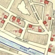
Return to Pulteney Bridge and cross over to Grand Parade. On the far side of the river, just below the bridge, there is an inlet (7). This was the start of the leat which channelled water to Bathwick Mill. The mill itself stood on the pedestrian walkway beyond, under the trees in front of the courtyard of the Boater public house. The present decorative weir, which incorporates a flood gate just past the island at the far end, dates from 1975; the old weir was straight, running diagonally from just below the leat to the near end of the present weir. It provided a head of water for both Bathwick Mill and Monks Mill.
Over the road, a little to the left, is Boat Stall Lane (8) which runs along the side of the Rummer public house. Near the end of the lane is the old east gate, the only surviving gate from Speed's time. Originally it lay further south, somewhere near the entrance to Parade Gardens, but around 1100 it was moved to its present location when John of Tours (bishop of Bath and formerly William Rufus' physician) rebuilt and enlarged the cathedral and close (PD).
The east gate was the smallest of the city gates. Major roads ran from the north, west and south gates to London, Bristol and Wells, but the east gate just provided access to the river. It was known as the Lot or Lud Gate, from the Old English word "ludgeat", or postern gate (JM). Part of the wall to the left of the gate (looking into the city) survived until 1901, when the Empire Hotel was built. The narrow lane which ran along the outside of this section of the wall was known as Lot Lane; in medieval times it would have continued to Monks Mill (9), in what is now Parade Gardens (PD). Inside the gate the line of the old road can be seen, curving left until it is lost beneath the council offices.
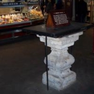
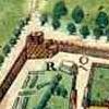
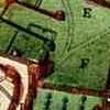
The triangular car park formed by the road and the surrounding buildings was the site of Speed's Guildhall (10), first mentioned in 1355 and demolished around 1625 (PD). As you enter the car park, turn to the right and you come to the entrance to the market (11). There has been a market on or near this spot for over a thousand years. The present covered market was built in 1861 on the site of the earlier 18th c. market place. Inside, round to the left, the old 'nail' can still be seen; a stone pillar, believed to date from the 1770s, where business transactions took place. Hence the expression "pay on the nail".
The market to Parade Gardens
Emerge from the covered market out into the High Street. A few yards to the left, in the middle of the road, was the market house (12). Markets were probably held in the High street from Saxon times (JM). In Medieval England the church, as well as relying on donations from wealthy benefactors, also controlled moneymaking ventures such as markets and fairs, using part of the revenue to provide alms to the poor. By the middle of the 16th c. however, the balance of power in the city had changed. The leading citizens, who made up the Guild, were now firmly in charge of the economic life of Bath. It was they who in 1551 constructed the market hall shown by Speed, on the site of the old market cross (PD). Behind it were the pillory and stocks. Produce sold in the market included geese, hens, turkeys, apples, pears, cherries, cabbage, carrots, peas and corn (JW). All in all it seems quite a varied diet (assuming you had money enough to afford it), though the produce on sale would have varied with the seasons. The market hall was rebuilt around 1627; the upper story became the new Guildhall, replacing the one just inside the east gate. It was finally demolished when the present Guildhall opened in 1777 (JM).
In 1572, during the period when the abbey was falling into disrepair, houses blocked the end of the High Street. Speed has a single row abutting the north transept of the abbey, though it is not certain how accurate the detail on his map is. On the 1725 plan drawn for the Duke of Kingston more extensive development is shown; this is marked on the accompanying map in orange (13). Either way, in 1610 there would not have been an uninterrupted view of the north face of the abbey church, as there is today.
At the bottom of the High Street turn left past Browns restaurant and the Empire Hotel. The original Norman cathedral extended roughly as far as the obelisk to your right; the rebuilt abbey church is significantly smaller. Cross the road to Grand Parade, to the corner overlooking Parade Gardens and the river. Below you in the gardens was Monks Mill (9); the leat would have cut the corner of Grand Parade where you are standing. The mill was mentioned in Domesday (JM), so it was probably there from Saxon times.
Parade Gardens to Ham Gate
Turn back and cross the road, just past the entrance to the gardens. Bear left, following the row of buildings running diagonally to the Abbey House Hotel (14). These buildings are another of those ghostly imprints from the past. The line of the wall runs parallel with them, about a dozen yards to the left, clipping the corner of the Huntsman public house before disappearing under the hotel. The triangular island formed by the road, once the site of public toilets which later became a nightclub, is known locally as Bog Island.
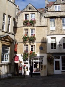
At the Huntsman, turn right into North Parade Passage. The detail on the Speed Map is unclear, but Gilmore 1694 shows a gate here. A few yards along the passage is Sally Lunn's teashop, which claims to date from c.1482. Although a row of houses is marked on the Gilmore Map at this point there are none recorded on the earlier Speed Map. Sally Lunn’s may incorporate fragments of an earlier structure, but the present building probably dates from around 1620 (PD).
Turn left into North Parade Buildings (looks like a film set!) and walk to the end. The backs of the houses on the left are built on the line of the wall (another of those ghostly echoes). At the end, go down the ramp. The wall at the bottom, on your right-hand side, is part of the old abbey precinct (15). Don't follow it but turn left into a covered passage (this is closed at night - in that case you could follow the precinct wall out into Abbeygate Street, left at the far end and left again to rejoin the route). About half way down the passage there is an opening into a car park. On the far side, to the left, is a fragment of the original wall marked by a plaque (16). You can see how it lines up with back of the buildings beyond. The city walls were largely intact until the beginning of the 18th century, up to 10 feet (3 metres) wide at the base and over 20 feet (6 metres) high (PD). They would have been a formidable defensive obstacle!
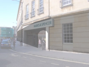
The passage emerges in New Orchard Street. To the southeast of the city, outside the walls, were the abbey orchards, remembered to this day in the modern street names. Turn right and you are following the line of the wall. This section was pulled down in 1959 when Marks and Spencer was built (PD). At the bend in the road you reach the entrance to M & S. Just inside, a few yards back from the road, stood the Ham Gate (17).
Ham Gate to South Gate
We have reached one of the less salubrious parts of Bath, then as well as now. The area over the road (still known as Ham Gardens) was bulldozed and rebuilt in the 1970s when architects and town planners were in love with all things concrete. Thankfully the council has now woken up to the fact that it is a complete eyesore, and there are plans to flatten it and start again. In Speed's time a stream known as the Bomdyche or Bum Ditch carried water from the Baths out through the Ham gate, along the line of the modern pedestrian street opposite. It flowed behind the properties on the east side of Southgate Street down to the river; the 1694 Gilmore Map shows it lined with privies (PD), effectively an open sewer. The toilets inside the city itself were mostly earth closets, but there was at least one public one, the 'Hame Privye' near Ham Gate (oddly enough there is still a public toilet near here). The earth from the closets was dumped outside the walls or thrown into the river, which could have done little for public health down in Bristol! In 1613 a byelaw came into force, ordering that dung be removed by scavenger's cart (JW).
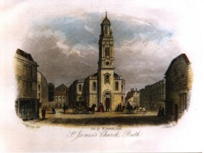
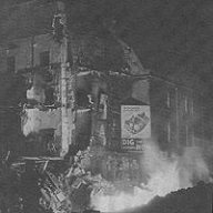
Follow the pavement to the next junction. Behind the wall of the present M & S stood the parish church of St. James (18), serving the southern part of the city and the area from the south gate to the river. It was originally sited on the west side of Abbey Green, and was moved to its new location in 1279 by Bishop Burnell, who converted part of the original church to a private chapel when he extended the Bishop's Palace (PD). Rebuilt in 1848, St. James was destoyed by incendiaries during the Baedeker raids of 1942, two nights of attacks which killed four hundred and seventeen people, mostly civilians (BC). Its pastoral role was assumed by the abbey, which is now officially the Abbey Church of St. Peter and St. Paul With St. James.
For an idea of what the first St. James might have been like, there’s a Saxon chapel at Bradford-upon-Avon, a few minutes from Bath by train. The chapel is across the river from the station, behind the parish church. From there it’s a short walk to the packhorse bridge and the medieval tithe barn.
The south gate stood at the junction (19), on the paved area in the middle of the road. In the 19th century this part of the city was notorious for vice and debauchery. Just past the junction on the left was the Bell, a tavern frequented by prostitutes. As the vicar of St. James' described it, "By day, even on Sundays, and within a stone's throw of St. James's Church, dissolute women, half-dressed, would stand in groups, soliciting passers-by. At night, riots, fighting and piano playing disturbed the whole neighbourhood. Respectable people were ashamed to live in or pass through such a district”. The Bell was finally closed down around 1880. The bracket that once held the sign can still be seen on the wall opposite Lloyds Bank (PM).
South Gate to the river and back
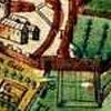
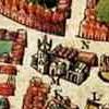
From here there is an optional detour. The river is to the left, past the road junction at the far end of Southgate Street. This part of the town was redeveloped in the 70s, and little of interest remains. In 1900 it was a tangle of shops, streets and little corner pubs (see map below).
In Saxon times the road from the south gate led to a ford, which was replaced by St. Lawrence's bridge in around 1200 (20). The bridge, which incorporated a small chapel dedicated to St. Lawrence, was a little to the right of the present pedestrian bridge. Beyond the river is the wooded area known as Beechen Cliff. Spring water issuing from the hillside was carried over the bridge and up to a conduit just inside the south gate. St. Lawrence's bridge was demolished in 1754 (PD).
Incidentally, Beechen Cliff is also the site of Bath's oldest hospital, St. Mary Magdalen in Holloway. Originally a private house and chapel, it was presented to the See of Bath by one Walter Hussey in around 1100. Perhaps because it was located well away from the city (although on the main road south to Wells) it became a leper hospital, caring for victims of the disease for over 400 years. By 1486 the original buildings were in a poor state of repair; they were rebuilt, some parts of the new hospital surviving the 18th and 19th c. redevelopments (PD JM).
From the river, return along Southgate Street to the junction with Lower Borough Walls (19).
South Gate to the Hot Bath
Continue along Lower Borough Walls. The line of the old city wall now follows the left-hand side of a series of modern streets round to the north gate: Lower Borough Walls, Westgate Buildings, Saw Close and Upper Borough Walls. Saxon fortified towns were laid out with a circular road just inside the defences, providing easy access to any point (JM). It's interesting to think that people have been walking here since 900 or thereabouts! Turn right just past the Lamb and Lion public house, and you are in medieval Binbury (now Bilbury) lane (21). The name may in fact be Saxon: Old English "Binnanburh", within the fortified place (JM PD).
In 1435 four almshouses were built in Binbury, on the left side as you enter the lane (22). Three more were added in the 16th c. This was the first St. Catherine's Hospital (St. Catherine, the patron saint of weavers, was adopted by the wool town of Bath). The almshouses lasted until around 1825. A new St. Catherine's (23) was built in 1553, on the right-hand side just past the junction with Beau Street (formerly Belltree Lane) (PD). It was known as the 'Black Almshouse', as the inhabitants were given a coat of black cloth every year (JW).
Hospitals in medieval times were not primarily places for healing the sick, though some, such as St. Mary Magdalen in Holloway, did look after them. They might provide care and accommodation for the elderly and infirm (as St. Catherine's and St. John's did and indeed still do). They might offer lodgings to pilgrims, or needy travellers (JM). Bellot's hospital (24), on the corner of Bilbury Lane and Beau Street, was built by Thomas Bellot for poor visitors seeking treatment at the spa. First mentioned in 1608, there was an inscription above the door: 'Do not leave dormant in your store that which would relieve the poor. If the poor sleep soundly, so will you.' (JM)
Interlude - BANES Folly
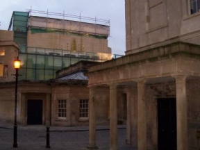
The glass building on the corner is the Bath Spa. To mark the millenium Bath and North-East Somerset council (BANES) decided to redevelop the old Hot Bath. Originally a pool used by local residents, it had been closed for a number of years. The project was financed by lottery cash, as well as money from the local council and private investors. What followed is a classic story of mismanagement.
First there was the design. BANES went for a hyper-modern construction sheathed in glass. It may have looked good on the architect's drawing board but it is completely inappropriate in a part of the city notable for its elegant Georgian buildings of Bath stone. And no one was surprised when all that glass in a quiet back street was regarded as a challenge by the local vandals, who proceeded to smash a number of the panels at ground level. No one, that is, except the council, who seem not to have considered the possibility. The bill for repairing the damage is likely to run to tens of thousands of pounds.
Then there was the open-air rooftop swimming pool. Nice touch. So at any rate thought the seagulls, who used it as a target on low-level bombing raids. At one stage a canopy was talked of, to protect bathers from the hail of guano descending from on high, though this seems not to have happened. Perhaps they just had a quiet word with the birds.
The roof-top pool was soon back on the front page of the local newspaper when it was discovered that the paint used to seal it was peeling away. The council claimed that the contractors had used the wrong paint, the contractors said that they were only doing what they had been told to. The question has been left to the lawyers to decide, but in the meantime the pool had to be resealed using something that worked. At a cost of £4 million. There are several similar spa pools on the Continent, so one would have thought that the issue of peeling paint had long since been resolved. It seems that one would have been wrong.
The projected opening date of 2002 was quietly removed from the the official website. 2002 became 2003, and the Three Tenors, no expense spared, were booked to perform at the grand opening ceremony. Messrs. Domingo, Pavarotti and Carreras duly came and went, but the doors of the Spa remained firmly shut. Eventually the staff were laid off and the contractors replaced. The new builders have been busy repairing leaks, repacing tiles etc. with a view to having it open for business in 2006.
How long it will stay open is anyone's guess. The grand idea was that the Bath Spa would be the eighth wonder of the civilized world, drawing crowds of rich tourists to the city, filling hotels and restaurants and generally revitalizing the local economy. In fact, far from bringing money in the Spa has been a financial black hole. The original planned cost was £13.5 million, but so far the bill is close to £45 million. No one knows how much of the massive overspend will be picked up by the taxpayer until the lawyers have sorted out who is liable for what, but the best guess is, most of it. And what happens if the project makes a loss? Will BANES pour in yet more money, in an effort to keep it going and save face? Hopefully not - although given the lack of shame-faced resignations over the fiasco so far, or indeed any expression of shame whatsoever, you have to wonder. As it is, millions of pounds of public funds that should have gone on local services have been squandered on an expensive playground for a privileged few. Most of the residents of Bath, the people who actually paid for the Spa, could never afford to use it (WP).
Postscript: it now appears (November 2006) that the final cost to the tax-payer will be £34 million, rather than the £3 million originally planned. However, because of the way the contract was drawn up, the council's share of the revenue (if any) is calculated based on an original investment of £3 million. The other £31 million has been quietly written off. BANES folly, indeed.
Turn left along Beau Street, then right into Hot Bath Street. The entrance to the Hot Bath is immediately to your right, though the bath in 1610 was actually in front of the present building, in the street where you are standing (25). It incorporated a small segregated bath for lepers from the nearby Lazar's Hospital. Straight ahead is the Cross Bath (26), with St. John's Hospital to the left. The Cross Bath was extensively remodelled in the 1590s, at about the time the Queen's Bath was built (PD). Towards the end of the 16th century Bath was becoming increasingly popular as a spa. It attracted the rich and the fashionable, along with doctors to attend them. New arrivals would be approached by touts, offering lodging in private houses as well as the inns of the city. A personal physician could also be provided if necessary. The different baths were believed to have special healing properties. The Cross Bath was recommended for 'young, tender bodies', the Hot Bath for 'colds and moist diseases' (JW). A later visitor was the diarist Samuel Pepys. In 1668, after spending several hours in the Cross Bath, he wrote: "methinks it cannot be clean, to go so many bodies together in the same water" (AB). It's an interesting point! One wonders how many people acquired diseases, rather than being cured of them, at the baths (JM).
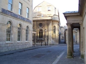
To the left is the Hetling Pump Room, closed now but a reminder that the Grand Pump Room outside the abbey was not the only place in Georgian Bath where the waters could be drunk. In "The Pickwick Papers" Charles Dickens provides an amusing, if slightly facetious, account of the custom. Mr. Pickwick, we are told, "took them systematically. He drank a quarter of a pint before breakfast, and then walked up a hill; and another quarter of a pint after breakfast, and then walked down a hill; and after every fresh quarter of a pint, Mr. Pickwick declared, in the most solemn and emphatic terms, that he felt a great deal better, whereat his friends were very much delighted, though they had not been previously aware that there was anything the matter with him". By the way, for those who have never tried spa water, P.G. Wodehouse's description of the stuff, as tasting like a couple of last year's eggs beaten up in sea water, may serve as a timely warning! Jane Austen refers to the Hetling Pump Room in a letter of 1799 (JA)
Hot Bath to West Gate

Turn left just past the Hetling Pump Room and you enter a narrow passage leading to Westgate Buildings. Cross the road and look back. The large building to the right of the passage from which you have emerged is Abbey Church House (27), It was built around 1590 on the site of the medieval Lazar's Hospital, and was one of a number of high-class buildings that sprang up in the vicinity of the baths to accommodate the rich and famous - among them Sir Walter Raleigh, he of tobacco and potato fame. Abbey Church House was patronized by Elizabeth's courtiers on their visits to Bath. It was badly damaged during the war, and the present facade is a reconstruction, though parts of the interior survive (PD JM).
The original road to the Hot Bath bore the curious name of Nowhere Lane. It ran along the right-hand side of Abbey Church House. The existing street, further to the right, is a later addition.
Crossing back to Abbey Church House, continue north along Westgate Buildings. The city walls were on the other side of the street, along the line of the shop fronts. You pass St. John's Hospital, with its pleasant gardens, and a narrow passage called Chandos Buildings opening to the right, before reaching Westgate Street. The old west gate of the city was situated partly on the road, and partly on the pavement where the tourist information post now stands (28).
Although there was probably always a gatehouse of some kind, Speed shows a more complicated structure. In 1572 the west gate was rebuilt and high status accommodation added. Queen Elizabeth stayed here when she visited Bath in 1574 (PD). During her visit the City Chamberlain paid 12s 8d to provide dinner for her at the Harte Inn. The place was also smartened up in honour of the occasion; 2s were spent cleaning the city walls (presumably just the bits that she would have seen?) and 4s 4d on re-glazing St. Mary of Stalls and St. Michael's churches (AM). Bath had reason to be grateful to Elizabeth; in 1573 she had authorized a nationwide collection to provide funds for the rebuilding of the abbey. A booming tourist trade and a royal visit. Bath at this time was going places!
Westgate to Cheap Street
Continue up the hill towards the theatre. In 1694, on the other side of the road, was the cock-pit (29). The area in front of the theatre, known as Saw Close, is marked on the Speed Map as The Timber Grene (30). In 1990 a 12th c. sawpit was excavated here (PD).
Just past the theatre the road turns right and becomes Upper Borough Walls. At the junction there was a low tower called Gascoyne's Tower (31), forming part of the defences. Continue along Upper Borough Walls, past Bridewell Lane (32). This alley may date from Saxon times (JM). In the 13th c. it was known as Plumtreoswichene, or Plumtree Lane (PD), and appears on the Speed Map as Spurier's Lane.
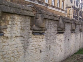
On the left, opposite the Royal National Mineral Water Hospital, is the third and final fragment of the old city wall (33). Until 1849 it formed the edge of a cemetery, surviving the development of the area. Although it has been partly restored it is thought to look much as it did in Speed's time (PD), though the level of the ground outside might have been lower (ground levels tend to rise where there is human activity). While the wall may be the same, however, the view is markedly different. In 1610 a person standing on the ramparts would have looked out over the Barton estate to the hills beyond.
Continue along Upper Borough Walls, past Union Street, and turn into Union Passage (34). In 1430 it was Paynestwichene, later becoming Cox or Cockes Lane. Like Bridewell Lane it may well be Saxon (PD). It emerges in Cheap Street.
Cheap Street to the Grapes
Turn right into Cheap Street and continue to the junction with Stall Street. Until the beginning of the 15th c. Cheap Street was known as Sutor or Shoemaker's Street (JM), perhaps the abode of those 16 shoemakers mentioned earlier. There was a conduit on the corner, known as the Bear Conduit after a public house nearby (JW). From this point you can see as far as the line of the city walls in every direction, though in Speed's time the view to the north would have been blocked (Union Street was not opened up until 1809). On the corner of Stall Street, partly under the old Roundhouse public house, stood the church of St. Mary of Stalls (35). It was once the Guild church, with a chapel dedicated to St. Catherine (the patron saint of Bath), but like St. Mary By The Northgate fell victim to the rebuilding of the abbey. In 1593 it became a commercial property, and was finally demolished in 1659 (PD).
From the junction with Stall Street continue along Westgate Street to the Grapes public house (36). Before the rebuilding of Bath in the16th c. most houses would have been two-story timber buildings, with thatched roofs. The skyline therefore might have been half its current level. From the middle of the 16th c. and into the 17th c. the old medieval houses were replaced by three and four-story stuctures (PD). On his visit in 1668 Samuel Pepys was struck by the fact that in Bath the houses were of stone, rather than wood as was the case in Bristol and London. He also commented on the fact that the town was clean and the streets narrow, so perhaps those 1646 bylaws were starting to take effect (AB)!
The Grapes
The Grapes is one of the oldest surviving buildings in Bath, with a history that goes back to the early 12th c. In January 1317 or 1318 one Thomas Fraunceys gave to Robert Aston "all his right in 4 shillings of yearly rent which he was wont to take from Adam Fullo for a tenement [lodging house] ... in Westgate Street, situate between the lane which leads towards the church of St Michael, on the east, and a tenement of Richard Fullo, chaplain, on the west" (NA). The tenement referred to was clearly on the site of what is now the Grapes, and presumably Richard the chaplain and Adam were related. Interestingly, there seems to have been no problem with a priest owning and renting out property at that time. In July 1387 it was recorded that "Thomas Saundre, chaplain, wills and grants to the mayor and Commonalty four shillings annual rent issuing from a tenement in Westgate Street, lying between the tenement of Richard Fullo, chaplain, on the west, and the lane leading to St. Michael's church, on the east, by which one goes to the Cross Bath" (NA). The Richard Fullo mentioned here can hardly have been the same as the 1317 one, though he may have been a descendent. Nothing like keeping these things in the family! Four shillings doesn't sound much, even in those days, though perhaps Thomas Fraunceys and later Thomas Saundre only received a part share of the annual rent.
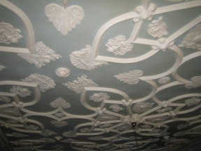
Be that as it may, the Grapes you see today dates from around 1620. It was originally a private house, probably built for Richard Gay, mayor of Bath and later its Member of Parliament. The pub only occupies half of Mr. Gay's house, the other half being the shop next door. The present facade (and it is just a facade) was added around 1720 but the building behind is Stuart, one of the few from this period still surviving in Bath. In the front room is the only Jacobean plasterwork ceiling in Bath (JM). In the mid 17th c. a Dr. Ostendorph lived here. If physicians could afford places that size there was clearly money to be made from the Spa. Later the house was a wine merchant's, before becoming a public house around 1800. The occupant in the 1901 census is recorded as George Phipps, from Bristol, 23 years of age, and a Licensed Victualler by trade.
In the darkest and furthest corner of the cellar is a small recess by some known as the spooky room. The stonework of its barrel roof is rougher, unlike anything else down there. This is interesting, because from the 12th to the 16th centuries, behind the tenements that fronted Westgate Street, stood the church of St. Michael Within The Walls. The Grapes cellar extends beyond the main part of the pub, under the toilets which were added onto the back. It is just possible, then, that the creepy corner was once part of the church crypt. It's a nice thought anyway. There's a large fireplace in the main cellar, which may have been Mr. Gay's kitchen - not that Mr. Gay would have spent much of his time there. By 1610 coal from the nearby Somerset coalfields was being used as fuel in Bath (JW).
The Grapes to Stall Street
Walk along St. Michael's Passage next to the Grapes, as far as the Cross Bath (26). The Cross Bath once cost a monarch his throne. Well, sort of. In 1687 Mary of Modena, wife of the Catholic James the Second, while staying in the Royal apartments above the west gate visited the Cross Bath (JW). Soon afterwards the childless queen fell pregnant, and in June 1688 gave birth to a son. For the Catholic minority in England the Catholic heir of a Catholic monarch was a cause for rejoicing, since it offered hope of a return to the Roman faith. For the Protestants however it was a disaster, and they acted swiftly. By the end of the year James was in exile and William of Orange in London. By the following year William the Third was king of England (AB JM).
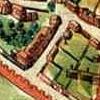
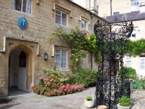
To the right of the Cross Bath is St. John's Hospital (37), which was founded around 1180 (PD JM). Originally run by the church, it was acquired and enlarged by the Guild in 1572. Twenty years previously the Guild had been granted monastic property and control of the baths. The profits from these were used to support the city's hospitals, as well as St. Edward's free school (PD). The present hospital was built by John Wood the Elder in 1728. It is administered by a charitable trust which also looks after St. Catherine's and Bellot's, providing sheltered accommodation for over a hundred elderly people. The chapel of St. John's is open daily, and services are still held there. Although it is not very old, it's a pleasant place to sit for a while and think.
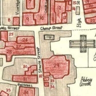
From the Cross Baths walk along Bath Street (38). Despite its uniform architecture this must be the coldest, dreariest street in the city. When you reach the end, look to your left. The shops behind the colonnade, facing the Abbey Churchyard, have replaced the old White Hart (39), once Bath's principal coaching inn. The Pickwickians stayed there when they arrived at the start of their immortal visit, as did the Musgroves in Jane Austen's novel "Persuasion". The plan shows the inns in this quarter in 1694. There were at least forty-four in the city as a whole, an indication of the importance of tourism then. The White Hart is number 28. It later expanded to incorporate 26 and 27.
Stall Street to Abbey Green
Turn right into Stall Street. On the left, just past the junction with York Street (which didn't exist in Speed's day), there stood another inn called the Three Tuns (40), number 29 on the plan. In 17th c. Bath, alehouses without 'lawful title' or license had to remove their signs and pay a five-pound fine (a lot of money back then). In 1622 the landlord of the Three Tuns, one Phil Sherwoodson, who had already fallen foul of the law for 'sundry disorders' committed in his house, was visited by the town bailiffs. As they approached they were met by his son, armed with a loaded gun and backed by a large crowd. The bailiffs, no doubt feeling that they were not paid nearly enough for this sort of thing, beat a hasty retreat. They returned under cover of darkness and removed the signs, only to find them back up the next morning (JW). Law-enforcement must have been a thankless task in those turbulent times! The yard of the Three Tuns is shown on the 1725 Kingston map, so the inn was still in existence then.
Turn left into Abbeygate Street and continue past Swallow Street. The gate into the abbey precinct was across the road at the far end (41). The Bishop's Palace was behind the shops on the left (42); to the right was Leer Lands, a lane which led to the Ham Gate and the church of St. James. Once it was used by monks driving their sheep out to pasture on the Ham (PD).
Turn left at the end of Abbeygate Street. On the right-hand side of the arch is an old hinge set into the wall. All that remains of the Abbey Gate, it was placed there when the gate was removed in 1733 (PD). Passing through the arch you come to Abbey Green (43). The road on the left side of the Green probably lies over the old Saxon road running down from the North Gate, which would have deviated round the abbey before continuing south to Ham gate (JM). The first St. James, the one that became the bishop's private chapel, was on the left, somewhere near the Crystal Palace public house (JM).
The buildings on the right side of the Green are shown on the Kingston Map of 1725, so they are probably pre-Georgian. Number 2 is interesting. Like the Grapes the facade looks to have been added later; and there are several windows, and evidence of extension, which suggest that parts at least pre-date the 18th c. rebuilding of the city (JM).
Incidentally, a friend who used to live in an 18th c. flat just round the corner in North Parade Buildings had some amusing conditions attached to the terms of his lease. He was prohibited from hanging bedding out of the window, holding public auctions and keeping livestock. One can only presume that the Georgian city fathers, having gentrified Bath at great expense, were concerned to prevent the locals spoiling things by falling back into their old peasant ways.
Abbey Green to the Abbey
Leaving Abbey Green you come out onto Kingston Parade (44), the broad open space in front of the abbey. Originally the right half formed part of the old abbey cloisters, which extended south from the church. Under the left half lies the eastern end of the Roman Baths. Beyond the Baths, where the Pump Room is now, there was once a tennis court (45). An act of 1541 prohibited tennis, dice, cards, bowls and other 'unlawful games' on Sundays. Presumably among the unlawful games was bull and bear baiting, a bloody spectacle which took place outside the walls until 1603. Less gruesome entertainments included 'bag pype players' in 1569, 'acrobats' in 1578 and 1579, and a 'blind organ player' in 1616. Theatre companies from London also performed in the city, particularly when there was plague in the capital and they were forced to go on tour. Each company had a royal or aristocratic patron. The Queens Players, the old Earl of Worcester's Men, visited annually from 1583 to 1607. The Earl of Hereford and Lord Derby's Men also passed through. But perhaps most interesting, from a historical point of view, were the King's Men, formerly the Lord Chamberlain's, who were in Bath in the plague year of 1603. Among them was an actor and dramatist by the name of William Shakespeare (JW IW).
When you reach the abbey itself you have arrived at the centre of things. Turn left for the Pump Room, the Roman Baths and abbey. Or for more history there is an interesting museum in the vaults underneath the abbey itself. The entrance is round to the right (46).