I awoke to the sound of a cuckoo calling. For some time I lay in my sleeping bag listening to the fluted notes, as the grey light crept through the trees; until a car flashed past and reminded me of what I should be doing. So I got up, and after a swig of water I was on my way.
I hadn't looked closely at the map, and wasn't really sure what to expect on this leg of the walk. I had a vague impression that I would be passing through flat country, with perhaps the odd hillock to provide some sort of a view.
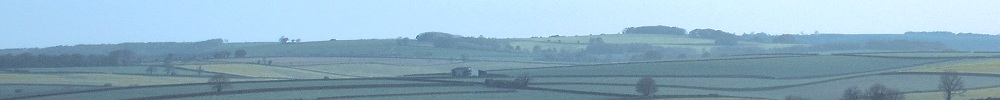
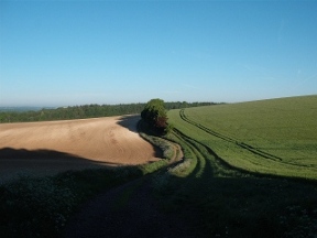
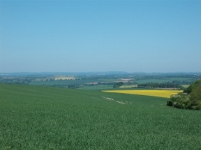
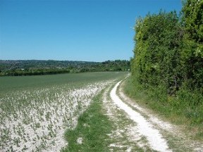
The first couple of miles were pretty much like that. I walked on tracks over bright uplands, where a cold breeze blew and the rising sun cast long shadows. It ended in a sudden, unexpected drop of several hundred feet and a wide vista of rolling hills.
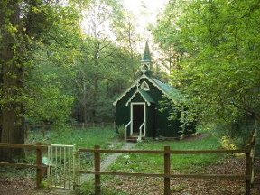
From the escarpment the path descended a slope and entered the woods of Bramdean Common. It was chilly under the trees, and I strode along at a good pace; until rounding a corner I stumbled on a tiny, corrugated iron chapel. According to a plaque by the gate, it had been built by the local lady of the manor for the benefit of charcoal burners living up in the woods. Whether they resented the loss of their Sunday morning lie in is not recorded!
Leaving the woods I crossed the fields to Bramdean. It was seven in the morning and the place was still asleep. I climbed the lane to the church, where I sat for half an hour on a bench. Suddenly I felt very tired.
The rest must have had some effect, for I left the tranquil churchyard with a renewed sense of purpose. This was slightly dented when I realized that the next quarter of a mile was all uphill. It brought me to the top of the ridge separating Bramdean from the small settlement of Hinton Ampner.
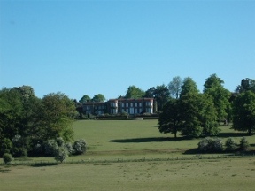
The Hinton Ampner estate is now owned by the National Trust and the house and gardens are open to the public. There I rejoined the Wayfarer's Walk, coming up from New Alresford. The Wayfarer runs through the park, a gentle stroll across sheep-cropped turf with fine views back to the house. Beyond the pale it climbs steadily for several miles until it meets the South Downs Way at Wind Farm.
From the top I could make out a double notch on the horizon: Beacon Hill, near Newbury. Looking out on twenty-five miles of Hampshire and back over three hundred miles of walking was slighly eerie. It was more than a year since I had passed Beacon Hill one evening in April.
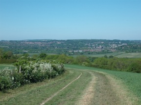
Once I had reached the South Downs Way I was back on familiar ground. I walked to Winchester with hardly a glance at the map. On the way I passed Milbury', and was tempted to hang about for an hour until it opened, but in the end I pushed on. The last few miles passed quickly.
I stopped briefly on the ridge above Chilcomb to dig out clean clothes and generally make myself respectable for the journey home. Then, looking moderately presentable, I set off for the city.
Lunch seemed called for and I obtained it at the Black Boy. It was fortunate I wanted a roast as it was Sunday and they were serving nothing else. The pub has a pleasant garden, and I sat outside in the sunshine munching my way through a large plateful.
From the Black Boy I walked on shaded walks, where willows dipped to the sparkling stream. Finally I emerged into the High Street. After two days alone in the countryside the confusion of the city was something of a shock.
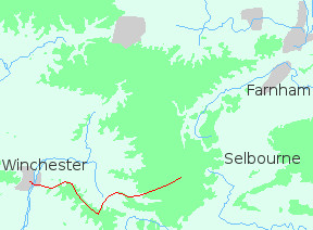
The next leg of the journey would take me on another trail, the Clarendon Way, to the capital of the chalk country - Salisbury.