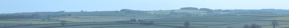
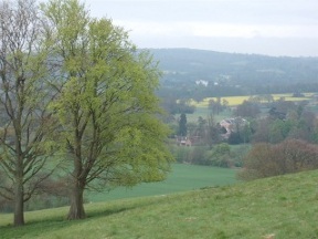
It was a murky morning as I descended Otford Mount. The downs on the far side of the Darent valley were vague shapes rising through the mist. At my feet, still slumbering, lay Otford.
I have fond memories of Otford. The last time I visited I arrived hot, hungry and footsore. I had slept out for several nights and badly needed a bath and a bed. I enquired at The Crown, and though they didn't do B and B the landlord phoned an elderly couple nearby who sometimes had a room. To this day I remember the comfortable bed and the wonderful breakfast next morning. I meant to write and thank them for their kindness, but somehow I lost their address. Perhaps I can thank them now.
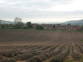
It was still early when I arrived in Otford; and though most places were shut I managed to obtain a bottle of milk from a small store which made some sort of breakfast. Leaving the village the Way passed some lavender fields (very Provençal) before crossing the Darent valley, mostly on main roads. Not the best going, but at least they had pavements.
I have two pieces of advice to offer anyone walking this section. The first is: don't plan on staying at the campsite near the M25 shown in the NDW guide, as it does not appear to exist. And the second is: once over the motorway do NOT follow the guide. When you reach Morants Court Farm on the B2211, take the footpath up to Star House and bear left to rejoin the Way. The official route keeps to the road, where there are no pavements, blind bends and fast-moving traffic.
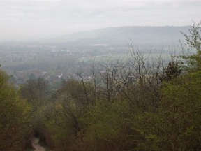
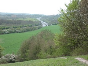
Having diced with death I climbed slowly back up onto the downs. Behind me the Darent valley looked faintly industrial, with clouds hanging like smoke from giant factories. Down to my left I could see Chevening, the country residence of Her Majesty's foreign secretary.
Once on top the Way winds round the back of Park Wood. The last time I passed that way I was astonished to see London in the distance. I could make out the towers of Canary Wharf on the banks of the Thames. I hadn't realized, but at this point the downs dwindle to a narrow wall separating London and the Weald.
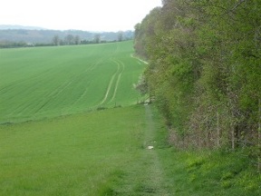
For several miles the track works along the ridge, down the edges of fields and along little lanes. There isn't much to see until it tumbles over the edge of the escarpment at Westerham Hill. Crossing the road it begins to ascend once more, up a gravel track leading into Chestnut Lane. During the climb it crosses the Kent-Surrey border.
The houses hereabouts are very Surrey: expensive, well-maintained and well-hidden. These bankers or whatever clearly value their privacy. I walked along the leafy lane past the entrance to a golf club, speculating on how much it might cost to become a member and how long the waiting list would be. Nearby Oxted is reputedly the most expensive village in England, which is some indication of the kind of money washing about in this part of the world.
At the end of the lane the Way descends; solely it would seem for the purpose of climbing back up again. Then, realizing that it was right first time, it slopes down to the base of the ridge.
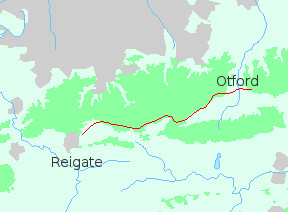
There's a long section at the foot of the downs, during which you cross the Greenwich meridian. (So that's the problem with the eastern section of the North Downs Way. Wrong hemisphere!) To your left the M25 is a constant companion, droning like a pub bore. Two more ascents and descents bring you to the A22.
I was being slightly facetious when I said that the eastern half of the walk was in the wrong hemisphere, but thinking back to the occasions I've done the North Downs Way there may be something in it. On both occasions I loved the section between Guildford and the A22 and disliked the rest. There does seem to be a change when you cross the meridian; to the west the downs are higher and more open, the paths more purposeful, and motorways are left behind. It's a different walk.
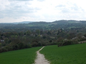
From the road the path climbs back to the grassy area at Pilgrim's Fort. There's a water tap here (handy for a wipe-down with a wet flannel if nobody is about!), and there are stunning views out over the lowlands. At your feet planes land and take off from Gatwick. Further still is the line of the South Downs. On a clear day you can see Chanctonbury Ring with its clump of trees.
After the viewpoint there are no more descents until Merstham. Though you soon wander away from the ridge the land is airy and open, less enclosed than the downs further east. Near Merstham I fell into conversation with a family from Berwick-upon-Tweed, the first I had had that day. Their typically Northern friendliness made me realize just how reserved people are on the Surrey section of the Way. I greet fellow pedestrians as a matter of course, but rarely got more than a nervous smile in return. No doubt many of the walkers I encountered had come down from London; and it may be that Londoners, who are forced to live with with ten million other people, just want to be alone when they are out in the countryside. But it was certainly odd.
On reaching Merstham the official route makes a bit of a detour to reach the centre. You can follow it or just turn left along the main road. I dined at the Feathers, which was ok though a bit trendy. If that does not appeal there are several other pubs to choose from. Then as the shadows lengthened I continued out over Reigate Hill golf course to Gatton.
Beyond Gatton Park school is an area of woodland owned by the National Trust where I had camped some years previously. After a brief search I found the place. In the darkness I settled down beneath my favourite oak, on a mattress of fallen leaves. And there in the depths of Nut Wood, where the roar of traffic was muted, I fell asleep to the stealthy sounds of the night.