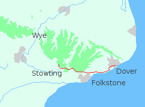
The North Downs Way can be divided into two parts. The first which is wholly in Kent is about fifty-five miles long. It runs south-west from Dover to Folkestone, then north-west to Rochester. Between Folkestone and Rochester it follows the line of the M20.
The second part continues from Rochester through western Kent, crossing Surrey from east to west before ending at Farnham on the Hampshire border. This section is around seventy miles long with half lying along the line of the M25 and M26.
The North Downs Way is not my favourite trail. Of all the chalk walks so far this is the one I would not revisit. I've done it twice now (the first time from Farnham to Canterbury) and on both occasions the people were helpful, the weather ok, and I didn't get injured or lost. So why wouldn't I go back there?
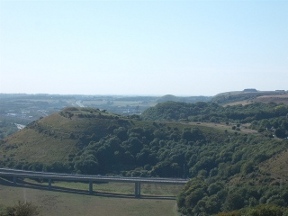
One reason is because the south-eastern corner of England is just too crowded. Two-thirds of the Way lie within a few miles of a motorway. You can stand on a hilltop at three in the morning and listen to the drone of traffic, the rattle of trains and the roar of aircraft. No matter where you are you just can't get away from noise.
Another is the nature of the trail. Long sections follow the base of the ridge where the views are limited. Others run through woodland and again there's not much to see. The whole thing has a slightly enclosed feel to it.
And Kent and Surrey are not my favourite counties. I don't dislike either, but they would not be my first choice when planning a walk. Kent is an odd mixture. Around Rochester and along the north coast it recalls London: brash, scruffy and noisy. Other parts are rural and remote. Surrey in contrast is cool, mannered and exclusive. And secretive. Expensive houses hide behind high walls, electronic gates bar the way, and CCTV cameras watch over all.
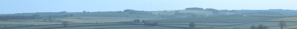
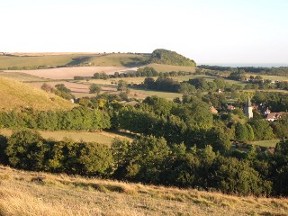
I don't want to paint too negative a picture of the North Downs Way, as there are some wonderful parts. The miles from Folkestone to Wye, the area round Reigate and Box Hill both come to mind. But the good bits never seem to last long, and all too soon you are back in the woods or down at the foot of the ridge. Or on roads. I can't recall anything to compare with the sustained ridge-walking, the wide skies and uninterrupted views of Dorset and the South Downs.
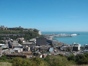
I set out from Dover on August Bank Holiday Monday. Dover is a bit of a dump: somewhere to get a meal and stock up on food, but not a place to hang about in. The famous castle was on the far side of the valley, so I gave it a miss and started up the long slope out of the town.
It was a blistering day, with a deceptive breeze coming off the sea. Walking in such weather can be dangerous as you don't really appreciate how hot you are getting. The route to the cliffs didn't help; an exposed path winding up to a fort before dropping back to the A20. Beyond the road was the long slog up to Shakespeare Cliff.
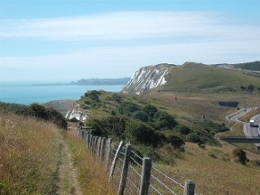
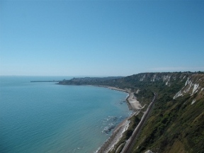
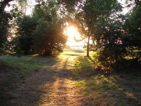
Once on top the going was better. The sky overhead was an intense blue; in the grass blue butterflies trembled; while far below the sea sparkled in the sunshine. Ferries, trailing long wakes, floated on still waters. Away to my left I could see a dark smudge: Cap Gris Nez, the Grey Nose of France.
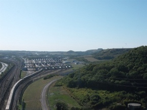
After Round Down the path is level until Folkestone where the cliffs come to an end. The North Downs Way avoids the town, bending north-west to stay on the high ground. Soon it passes the Channel Tunnel terminal where streams of lorries and cars are shunted onto long trains for the trip to the Continent. From then on it becomes more rural, and for the first time feels like a downland trail. There are miles of pleasant going with turf underfoot and views out over the flatness of Romney Marsh.
I walked for several hours across the chalk under a relentless sun. My shirt was wet where the rucksack touched, but any sweat on my face was wicked away in the fierce heat. When I finally reached Stowting I was seriously dehydrated. I sat on the terrace of the Tiger Inn, too hot to eat, drinking pint after pint of orange juice and soda. Then as the light was fading I went out to find somewhere to spend the night.
When it was too dark to go any further I pitched down a few yards off the path. It wasn't an ideal spot, but it was partially screened from passers by. For hours I lay there, feverish, listening to the trees groaning in the heavy wind blowing over the ridge, until my body temperature dropped and I could sleep.