I was up and away at first light. It had been a cold and restless night, and the presence of poachers in the next field, and the subsequent arrival of a police helicopter, had made matters worse. There's no doubt that the sound of shotguns and clattering rotors do tend to induce wakefulness - and the possibility of getting caught up in the cross fire is not appealing1
It was a fine autumn morning when I set off. The air was fresh, the sun streaming down from a pale sky. And if I had had a good night's sleep instead of a few hours of broken slumber, and a decent breakfast instead of a cheese sandwich, and a mug of coffee instead of a swig of cold water, I should have felt on top of the world. In spite of these disadvantages, and the fact that I had sore feet, it was still good to be there.
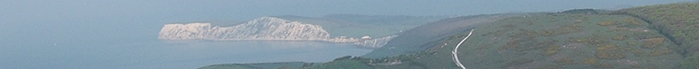
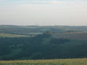
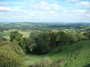
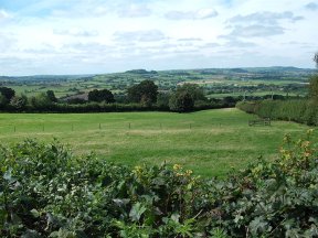
Eggardon Hill is a spur projecting from the main body of chalk. On three sides the land falls steeply to the upper Marshwood Vale. South and west of the hill there are glimpses of the sea. Five mile to the north a cluster of radio masts rises above the Toller valley. This is what's left of the BBC World Service shortwave radio station of Rampisham, shut down in 2011 as part of a cost-cutting exercise.
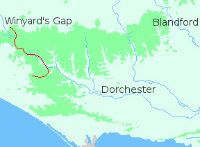
I spent half an hour on the hill absorbing the views, then turned back along the spur. I was aiming for Winyard's Gap, which lies north west of Eggardon. The most direct route would have meant leaving the chalk and dropping down to the Mangerton River, just above Powerstock, but I wanted to stay on the downs so it seemed better to strike north east to Toller Porcorum, then north west along the Toller valley.
The first few miles were easy enough: a slow descent along a hogs-back to Ferndown Farm. From there a footpath plunged to a small stream, where I got very lost and very muddy. Eventually I scrambled out onto the lane leading into Toller Porcorum.
Toller Porcorum - what a name. According to Wikipedia the river Hooke, which flows through the village, was once called the Toller. And "porcorum" in Latin means "of pigs". So Toller Porcorum is the village on the Toller with the pigs. Toller Whelme, higher up, is the place where the Toller rises (Anglo-Saxon "Whelme", meaning "river source" or "spring"). It's good to know these things!
I was glad to be down in the valley, since it meant that I could keep to the lanes for a few miles. As a Thomas Hardy fan I should have been proud to walk in the footsteps of Gabriel Oak and Bathsheba Everdene: the Toller valley is where the opening scenes of "Far From The Madding Crowd" are set. And I should have appreciated the quiet tranquility of green fields and slow-flowing waters. But I was very tired, and my feet were in bad shape. I trudged along, feeling sorry for myself, through Lower Kingcombe and Higher Kingcombe and Hooke, and on to the little hamlet of Toller Whelme.
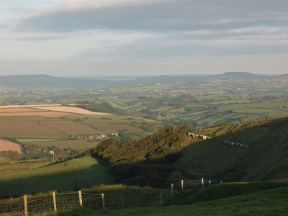
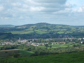
There the soft, pastoral valley ended. A short climb brought me out onto Hackpen Hill. From Hackpen a track led north, round the lip of a wide bowl of chalk to Beaminster Down. The views south to the little town of Beaminster were spectacular.
The last obstacle to be negotiated was the main road from Dorchester to Crewkerne. It lies along the downland spur leading to Winyard's Gap, and is quite unwalkable. Fortunately there is an alternative route, along the base of the ridge on the north side. It's not the most spectacular approach to the westernmost edge of the English downland, but it got me there in one piece.
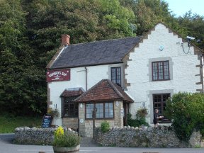
At Winyard's Gap I reached the end of a very long journey. It had begun some two years earlier in Dover; taken me across Kent to the Medway; round London; then through Surrey, Hampshire and Dorset to the edge of Somerset. As I sat in the pub garden looking out over the hills I felt drained, physically and mentally. I wondered if it would be wise to end the journey there.
In this mood of despondancy I asked at the bar about buses on from Winyard's Gap, or back to Maiden Newton. There were none, and the railway station at Crewkerne was five miles away. Thanking my informant and shouldering my rucksack I hobbled back to the main road, to try to hitch-hike somewhere, anywhere. Two minutes later a charming elderly couple who had been dining at the inn stopped and picked me up. They dropped me off in the centre of Maiden Newton.