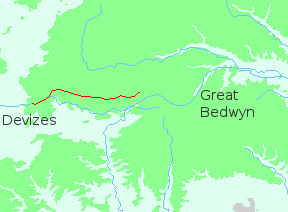
I set off from Devizes in fine weather. It was April and the scent of spring was in the air. The first blossoms clouded the hedgerows, fragrant in the warm sunshine. It had been a dry winter and the ground was firm underfoot; perfect for walking.
I was carrying a full-size pack as I intended to sleep out. I had a three-season sleeping bag, the flysheet of a tent, a groundsheet, sleeping mat and warm clothes. Before leaving Devizes I stocked up on food and water, since there were no shops or pubs anywhere along the route. I also purchased a small bottle of brandy, strictly for emergencies!
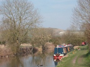
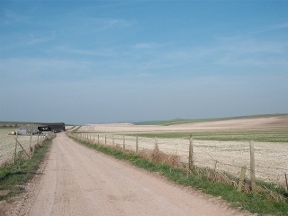
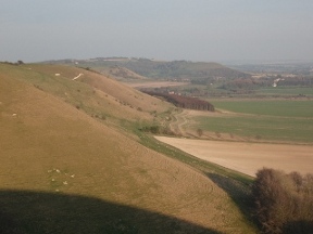
After Devizes the canal runs for a few miles through level fields, drawing ever closer to the hills. Near Bishop's Canning it turns south; and there I abandoned it, following a footpath which led to the broad track ascending the shoulder of Easton Down. I climbed through vast, empty fields ploughed flat for sowing. The torn chalk baking under a hot sky had the dry, dusty smell of the desert. And those fields looked like a desert. The downs should be grassland, cropped by sheep. This kind of prairie farming is a violation of the landscape.
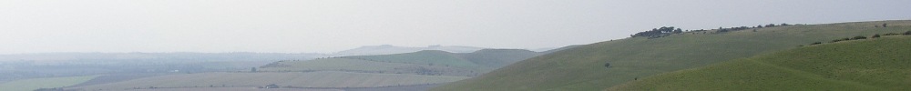
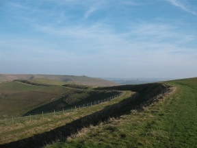
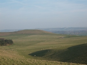
On Easton Down I encountered the earthen wall of the Wansdyke. Nobody knows how old it is - earth can't be carbon-dated - but it may have been constructed after the legions abandoned Britain for the last defence of Rome. It's not certain whether it was a fortification or a boundary marker, but it clearly faces north as the ditch is on that side. For twelve miles it follows the crest of the ridge, from Morgan's Hill to Savernake Forest south of Marlborough; a wonderful, winding walk with stunning views in every direction. From the heights of Tan Hill you can look south and west over the dry waste of Salisbury Plain to Great Ridge Wood, and beyond it to Bulbarrow and the hills fringing the Blackmore Vale. North and east you can see the radio mast at Fox Hill on the Ridgeway, and dim blue uplands too far away to identify. On a clear day sixty miles of chalk are visible - probably more. It's unbelievable.
The Wansdyke kept me company as far as Milk Hill. There it began to edge northward and there we parted. I descended a long grassy slope, aiming for the escarpment looking south over the Vale of Pewsey. At Knap Hill I picked up a bridleway marked on the map as the Tan Hill Way. This led me four miles east to Martinsell, my destination for the night.
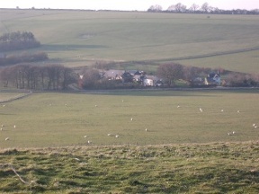
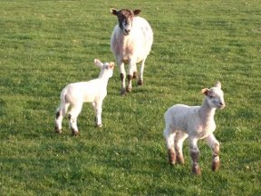
It was mid-afternoon when I left Devizes and by the time I reached Knap Hill I only had a couple of hours' daylight. The westering sun threw long shadows across the grass and the breeze faltered. I walked in the evening hush, watching as the villages of the vale grew dim. Up on the ridge it was still light, but under the trees night gathered. In one field some lambs ran towards me, curious at the sight of a stranger, until the panic bleat of the ewes recalled them to safety.
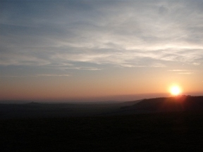
As the sun set it grew bitterly cold, the warmth of the day vanishing into the empty sky. I reached Martinsell in just enough light to pitch the tent. Though I didn't have time for an extensive search I found a half-decent spot under some trees on the south-east side of the hill. Fixing the tent was not easy as I had to take off my gloves and my fingers soon froze, but I got the thing up eventually. Finally I crawled into my refuge for some much-needed food and a go at the brandy. Well, sub-zero temperatures are an emergency!
I lay there for a while, my mind still full of light and colour, the sweep of the land and the wind blowing in the high places. Then at peace with the world I fell asleep to the sound of owls hooting in the night.