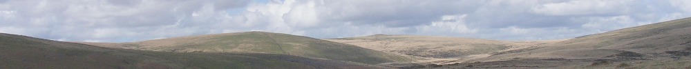
According to the Recreational Path Guide by John Macadam, the Two Moors Way walk is around ninety miles long. He breaks down the route over six days, which is probably about right. It may only be fifteen miles a day, but the moors will reduce the distance you can cover dramatically. The going is tough in places and there are a lot of climbs. Even in central Devon there are few flat bits, and Dartmoor and Exmoor rise to well over a thousand feet. I did not find accommodation too hard to come by, even on a bank holiday weekend (a wet one, admittedly). However pre-booking is probably advisable during the height of summer. There are a number of pubs on the way, but few shops; so it is certainly worth considering where you will eat. Not all pubs open in the afternoon.
Ivybridge station is on the main West Country line, though express trains do not stop there. Local trains run to Plymouth and Exeter. Lynton is more difficult to reach by public transport. You could take the West Somerset railway from Taunton to Minehead, though it is a tourist route so it may not operate in winter. From Minehead there are a very few onward buses. The other approach is via the Tarka Line, which runs from Exeter St. Davids to Barnstaple. There is a regular bus service on to Lynton.
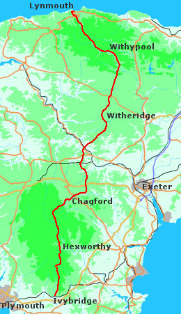
In central Devon and on Dartmoor I deviated slightly from the official route of the Two Moors Way; the maps on these pages show where I went. On Exmoor and Dartmoor I used the 1:25000 Ordnance Survey Explorer maps (PL9 and OL28). I found the printed extracts in the guide book adequate for the rest of the walk, although at times I would have liked to have had proper maps, just to see where I was and what was around me.
There's an aerial overview of the walk here.
Other sites
Descriptions:
- John Harlow's page.
- John Butler covered most of the route as part of his end-to-end walk. Stacks of pics.
- And Roy McKee ran it!
- Photo journal by a couple of BBC Radio Devon reporters. Not much text, but a good visual overview.
General information:
- Ramblers Association: accommodation service, route information.
- Walking Pages: contact details for local Tourist Information Centres and public transport.
- Ivybridge Tourist Website: a nice downloadable leaflet about the walk. It gives the address of the Two Moors Way Association, if you want to obtain their accomodation list in advance (if you're not worried about prebooking you can get this from Lynton or Ivybridge TIC when you set off).
- Devon County Council: includes some TIC and transport details.