I wrote elsewhere (it was in a discussion about walking equipment) that a bacon and brie baguette is more sustaining than prawn and avocardo. And so it is, in terms of calories. If you are not sure where the next meal is coming from, go for it! But if you have access to a steady supply of food, the low-fat high-carbohydrate diet recommended by sports nutritionalists is probably better.
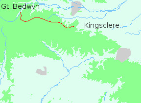
I mention this now because I spotted bacon and brie on the menu of the Cross Keys at Great Bedwyn and on an impulse ordered it. Afterwards I wished I hadn't. I left the village slowly, attempting to digest a large blob of grease.
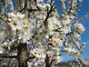
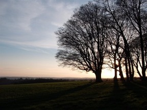
My way lay south-east to Shalbourne, on little paths through pleasant wooded country; then south to Rivar where the downs begin. Since the previous walk the year had advanced almost imperceptibly. In the hedgerows the blackthorn was in flower and on shaded banks violets and primroses blossomed. Under dark labyrinthine trees the first bluebells were beginning to emerge.
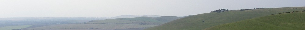
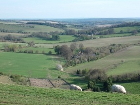
The gentle, undulating countryside came to an abrupt end at Rivar where the path angled up the face of the chalk. The climb under a warm sun was breathless, but the views as I reached the top were remarkable. I looked on the valley of the Kennet: woods, fields, villages dreaming under a clear sky. Then I set off along the ridge, washed by the breeze and the tumbled song of the larks.
From Rivar Hill it's a couple of miles to Inkpen Beacon. The beacon with its barrow and gibbet is a crossroads. The Test Way coming up from the south ends there; and there the Wayfarer's Walk starts the long journey to the sea. To locate it on the map and trace the radiating tracks from its summit is exciting. But to stand there on a fine day, gazing out over the lowlands and thinking of all the places you could get to, is inspiring.
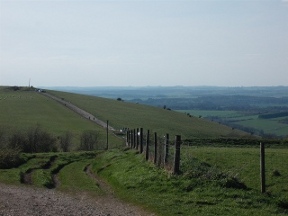
Inkpen Beacon - well strictly speaking Walbury Hill, half a mile to the east - has the distinction of being the highest point on the chalk. At 974 feet (297 metres) it's low even by British standards; but the nature of chalk, rising above river valley and coastal plain, means that wherever you are in the chalk country you are likely to encounter sweeping panoramas. Only in the flat pastoral landscape of Hampshire are the views circumscribed.
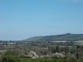
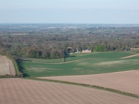
From Inkpen the track heads south-east along the crest of the ridge. To the left the ground falls away to rolling farmland. There the fields are fertile, the woods well-tended; and from the heights the solid farmhouses look like manors. A world of broad acres, fine properties, horses, and prosperity. And in the distance, rising above all, the bulk of Highclere Castle, home of the Earls of Carnarvon.
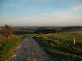
The six miles to Sidown Hill are easy going along a straight and level track. After the hill the path bends south, traversing the rim of a great bay in the chalk as it descends to cross the A34. Near the road there is a plaque marking the spot where de Havilland made his first flight. No airports or runways in those pioneering days when planes were constructed of canvas and wood and made their perilous ascent from flat fields!
When I reached the A34 it was growing dark and I needed to find somewhere to sleep. The path led up a shallow valley, along the remains of an old road. Fragments of tarmac were still visible in the grass. I considered the valley as a possible campsite, but immediately decided against it. The ground was rotten - there's no other word for it - burrowed by countless rabbits. In the failing light it resembled a great slab of maggot-infested cheese! The rabbits were everywhere, hopping across the path, unconcerned by my presence. I didn't fancy spending a night among that furry lot so I plodded on in search of a more peaceful spot.
And as always when the light is failing I couldn't find one! The slopes leading back to the ridge were wide and exposed. The few patches of woodland were fenced off and there were no hedges. Finally, just east of Ladle Hill, I came upon a low heap of earth, the remains of a small reservoir. Behind it in an angle of a field was a patch of stony ground. There was no chance of putting up the tent, but the night was fine and dry.
Later as I lay in my sleeping bag I looked down into darkness where cars like fireflies streamed through the night. Gradually the headlights and the distant roar of traffic faded, and I fell asleep in the silence of the heavens, and stars wheeling in the black immensity of space.