It was a hot and restless night. Overhead the wind blew fitfully through the treetops, but down in the wood the air was heavy and still. Several times I was woken by local wildlife scrabbling among the leaves. Then I would sit up and clap my hands, and listen to the patter of retreating footsteps, before dozing off as I awaited the next visitor.
I was up early, just as darkness was fading to grey. It was a dull, misty sort of morning, though there seemed little chance of rain. Leaving the shelter of the trees I set off through the fields.
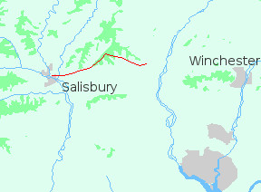
The track led over the dip and swell of the chalk to Buckholt Farm. There it joined the old Roman road to Middle Winterslow. From Winterslow the road continues west to the waterless hill of Old Sarum, site of the first cathedral. The Clarendon Way, however, bends more to the south, making for the confluence of rivers at Salisbury.
Middle Winterslow is an attractive place, built on top of a hill. My map showed the Way passing through the village before turning along the escarpment, but a sign near the centre directed me another way, over the playing fields and down an alley. I followed it, and five minutes later was back where I started. I finally located the correct path (far corner of the playing fields, behind the skateboard track) and set off once more.
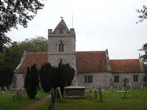
It's less than a mile to West Winterslow, where a tree-wrapped church looks out over a valley. As I passed the porch I heard the sound of choir and organ. On that grey morning the music was strangely moving; and I sat outside on a bench, listening, until the last sweet sounds faded to silence.
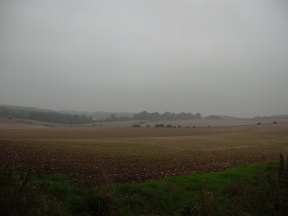
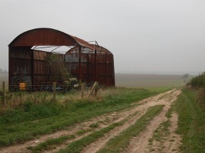
From West Winterslow the Way leads over the downs to Pitton. I stopped to photograph an old barn: the gaunt shape and the track disappearing into the mist seemed at one with the quiet loneliness of the chalk. It was still early when I reached the village, and being a Saturday there were few people about. A couple of early risers smiled and said hello as I passed through.
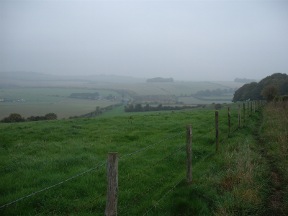
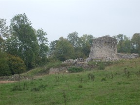
Much of the last section of the Clarendon Way lies through woodland. From Pitton you climb onto a chalk ridge, though you don't really notice this because of the trees. Once on top the track follows the crest of the ridge to Clarendon Palace.
The Palace, once a royal residence, was abandoned in medieval times. There's little to see now, just the base of some pillars and a few walls. Several notice boards are dotted about, and with their help it's possible to get an idea of how the place would have been. It's worth a look (if nothing else, it gave its name to the walk!) but you probably won't want to spend much time there, not with Salisbury beckoning.
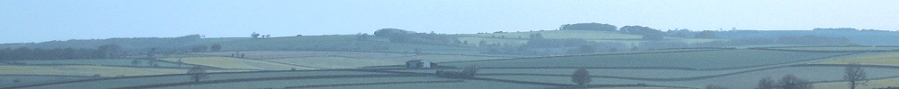
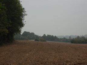
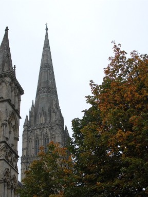
As you descend the ridge you emerge from the trees, and for the first time you can see the spire of the cathedral. Now the Way runs through farmland, down to the river Nadder. Across the bridge, one last hill and you are there.
Salisbury, city of five rivers: set in a wide sweep of downland, washed by many streams, its great glory is its cathedral. Is there another building, so perfect in itself and so perfectly situated? The graceful spire rising four hundred feet above the Close can be seen from every direction; a beacon for walkers out on the hills, and a sign of hope. This, surely, is the heart of the chalk country.
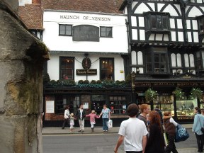
From the cathedral I found my way to the Haunch Of Venison; one of the oldest pubs in Salisbury, and my favourite. For travellers along the Clarendon Way, it's a welcome end to the walk.
Beyond Salisbury lies Cranbourne Chase - an ancient tract of country extending south-west to Blandford and the river Stour. More on that mysterious landscape to follow.