I left Winchester at the end of May. The forecast was for a warm day, followed by two days of unsettled weather, brightening up towards the end of the week. And for once the dear old Met Office got it right!
For the first time I didn't start walking exactly where I had finished the previous stage. From Winchester I should have travelled on to New Alresford, a few miles to the east; but the train was delayed and I missed the connecting bus. Conscience told me I should wait and catch the next one, but I didn't want to hang around for two hours - not with the sun sparkling on the river and the downs beckoning. So I turned my back on Conscience and set off.
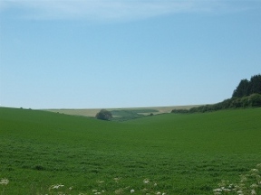
I said before (in an article on the Ridgeway) that travelling a familiar path in an unfamiliar direction is like being on a different walk. I found the same thing when I revisited the South Downs Way. I had previously walked it from east to west, reaching Winchester at the end of a cold and tiring day in November. Now I was just starting out and the year was moving towards high summer. Having already walked from Bath to Alresford that spring I was quite fit, and I bounced along the trail to Milbury's with little difficulty.
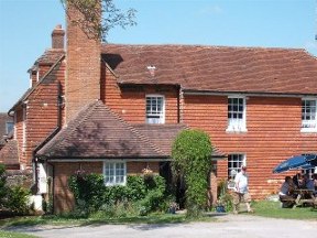
Milbury's. Where would we South Downers be without it! It was its usual obliging self, supplying ham, egg and chips, and cider in abundance. Suitably fortified I carried on, making for Wind Farm. At one point I passed a gap in the trees where the Wayfarer's Walk coming up from Alresford meets the South Downs Way. There I should have joined the trail, missing out on the pub altogether; though I can't say I felt particularly guilty!
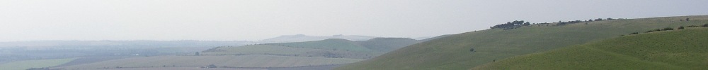
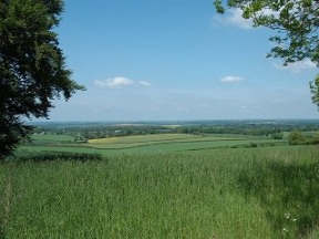
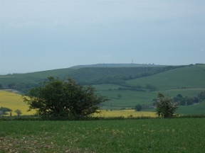
As you travel east along the South Downs Way the landscape changes. Around Winchester the chalk lies in long low swells. There are occasional inclines, but in general it resembles a wide, undulating sea. At Beacon Hill it alters. Now the hills are higher, and the slopes bolder. Beacon Hill marks the start of a new landscape, the classical downland of Sussex.
From Wind Farm to Beacon Hill the path keeps mostly to the south side of the ridge, with views over Portsmouth and the Isle of Wight. For the first time since leaving Bath I felt the influence of the sea. It was an exhilarating sensation and I strode on buoyed by sunlight and a blue sky. Or perhaps it was the cider. At any rate I was still moving well as I rounded the summit of the hill and began the descent to the Meon valley.
Approaching Exton I met a group of young people whose account of their day put my efforts so far somewhat into perspective. They were rehearsing for a charity walk with a modest training exercise of forty miles in twenty-four hours (and goodness only knows how far they were planning to cover come the real thing!) After chatting for a while we parted, they making for Winchester while I carried on the village.
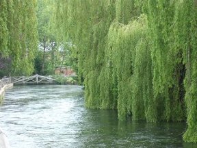
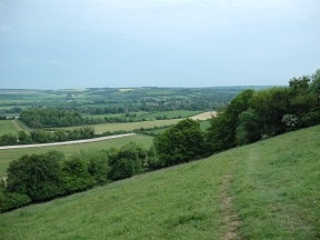
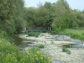
Beyond the village lay the Meon, tranquil in the afternoon sunshine. The cold, clear water was wonderfully soothing to my hot feet. From the ford the path led on, up a long breathless slope to emerge on a wide hilltop.
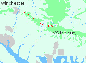
Old Winchester Hill is part of a chalk plateau linking Teglease Down, Hyden Hill and Butser Hill. There's a road across the top to HMS Mercury, little more than two miles away. The SDW however gets there by dropping down to the valley and climbing all the way back up again.
Actually that's not quite true. It goes a mile in the wrong direction and then drops down to the valley. I thought of the Pennine Way, a walk I did many years ago. On the Pennine Way, if there's a three-mile detour out across bleak moorland, avoiding a warm pub and a log fire... well, that's the way it goes!
The way I went was down, for more than three hundred feet. On the other side of the valley I ascended the long ridge to Salt Hill. From the summit a short walk brought me to HMS Mercury.
Mercury is a disused Royal Naval base, part of which is now the Sustainability Centre. Have a look at their website to see what they are all about. I had a vague idea that it was possible to camp there, and I was hoping that was the case as it was starting to rain. The first problem was finding someone. I eventually located them in one of the buildings, having a party! There was no reception as such - well, not that I could see - but I paid and was directed to the camping area. Although the leaflet I had been given contained a sketch map I missed my way and ended up down near the woodland burial site. Back to the yurt and tipis (see website), where a kindly fellow guest put me right.
The camping bit consisted of grassy bays hollowed out of earth mounds; very clean and secluded. The facilities at the site were basic (earth eco-toilets, which are not actually as bad as they sound), but it was a fun and friendly place to stay. I got a shower up in the main block then settled down for the night. I had covered nineteen miles from Winchester so I was quite tired; but all in all it had been a good start to the walk.